Sand & Swash–A Novel Adventure: report by Beri & Bessie

My Fellow Explorers,

Thank you for documenting your expeditions and making copies for Beri and I to read. We have enjoyed each photograph and story immensely. The perfect nightcap! Below is a recent account of my own.

I can’t quite explain how, but I had the wonderful and uncanny experience of stepping forward in time to the 11th of March, 1940, to board the Western Flyer vessel and see it off on its journey to the Sea of Cortez for the purpose of documenting the ecology of these relatively unexplored watery habitats. The voyage is to be documented by a marine biologist, Ed Ricketts, and a local man called John Steinbeck.

Posing with the Admiral, his wife, and the Western Flyer itself!

Monterey lindy-hoppers gazing off at the horizon, musing what adventures may come!

Met a Naval PostGraduate man and a naturalist!

A brisk walk aboard the vessel one hour before departure, accompanied by the sea shanties of local fishermen.

View from the Captain’s Quarters!

On-board entertainment!

The crowd of toe-tapping landlubbers gathers for one last photograph!

Dancing on the wharf, wishing a bon voyage to the captain and crew!

I regret not inviting you all to this send off, but if you’re ever passing through the old fishing village of Monterey, please make time for a dance with my friends of the “Cannery Row Jump!” You can easily find jive, jitterbug, lindy hop, and (my favorite) charleston lessons and dances every week of the year.

Respectfully,

Beri and Bessie

Posted in General Discourse | Leave a comment

Tourists, Traders, Adventurers and Explorers

Posted in General Discourse | Leave a comment

The 1924 Black Valley Petroglyph Expedition

Report by William Marcil

Esteemed Members of the Society, I am much touched by the reception I have received here. I hope the following tale shall be sufficient in proving my merit, and serve as initiation into this storied assemblage.

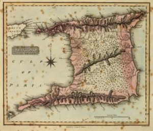
About a month ago, I was looking, out of idle curiosity, at a map of Death Valley and its surrounding environs, when I noticed a site, some miles to the southwest, marked “Black Valley Petroglyph Site.” Intrigued, I researched further, upon which I discovered that the site was part of the Black Mountain Art District, located in and around Black Mountain, California, consisting of well over 11,000 petroglyphs carved within the last 2000 years. I found myself wanting to see them personally, and my curiosity increased when I discovered that in the vicinity was an abandoned mine, from whence once flowed opals to Tiffany & Co.

I decided I would go. Immediately I identified a few problems, first and foremost of which was that the roads leading to the site were entirely unpaved. I do not own a car capable of taking such roads with ease, just a four door sedan, but it had seen me through my city driving, which had been reliably described by my passengers as “terrifying”. Additionally, while there were smaller dirt roads, there were ones large enough that it seemed to me to denote a usage common enough for some actual upkeep, and thus it seemed theoretically possible for my driving at least some distance on them. It also seemed far too much to explore in one day, but, upon conferring with members of Field Station 33, I decided to make my excursion a mere scouting expedition. My mind made up, my route set, I made the necessary logistical purchases, and before sunrise of January 31st, I set off.

My traversal of the paved roads was unexceptional, and a few hours later I found myself barreling past a sign stating “Pavement Ends,” and so it did. I knew I had overestimated my cars ability to handle these roads almost at once. The roads were firm, but for some reason, rippled. The car began jittering, rattling, every piece oscillating at a slightly different rate, threatening to shake apart. I spied a side street, and wanting an end to the vibrations, turned onto it, and immediately got my car stuck in the mud.

I attempted several methods to unstick my car myself, from alternating drive and reverse, to excavating out the tyre, to tying a bit of scrap wood to the wheel to try to give it treads. Nothing worked. Despairing, I wandered down the desolate street until I found a strapping young lad named Ruben who agreed to help me out. Through the vaunted power of teamwork, we got my car unstuck, but I had burned two hours of daylight in so doing. I returned to the main road, and its jittering, and made my way toward the mountain.

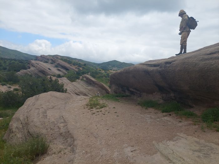
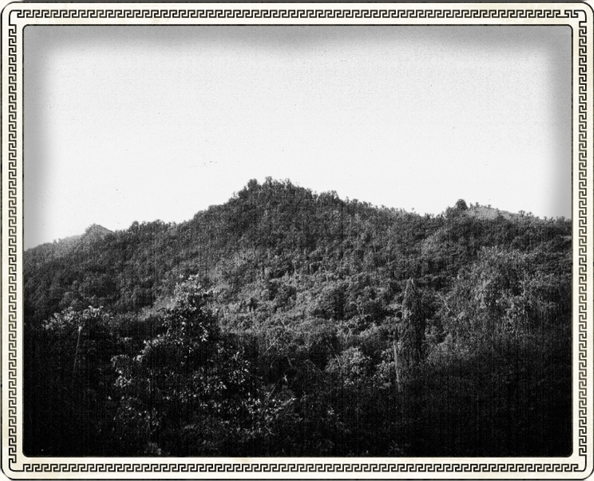
The oscillating did not cease as I approached my destination, and, continuing to fear for my car’s suspension I pulled off to the ruins of some sort of plinth on the side of the road. I could see the mountain in front of me, to the north not a mile distant, and I thought I saw the entrance to the Black Canyon. I retrieved my gear, checked my map and compass, and set off.

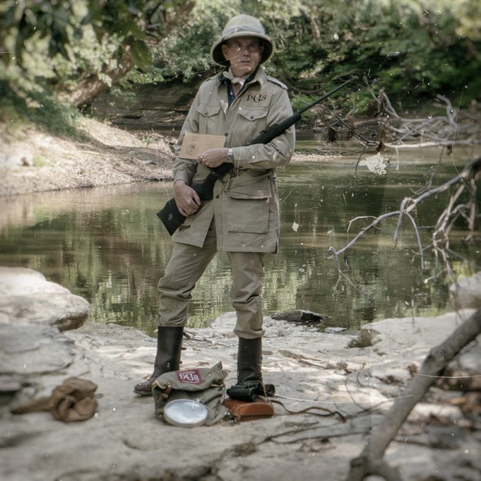
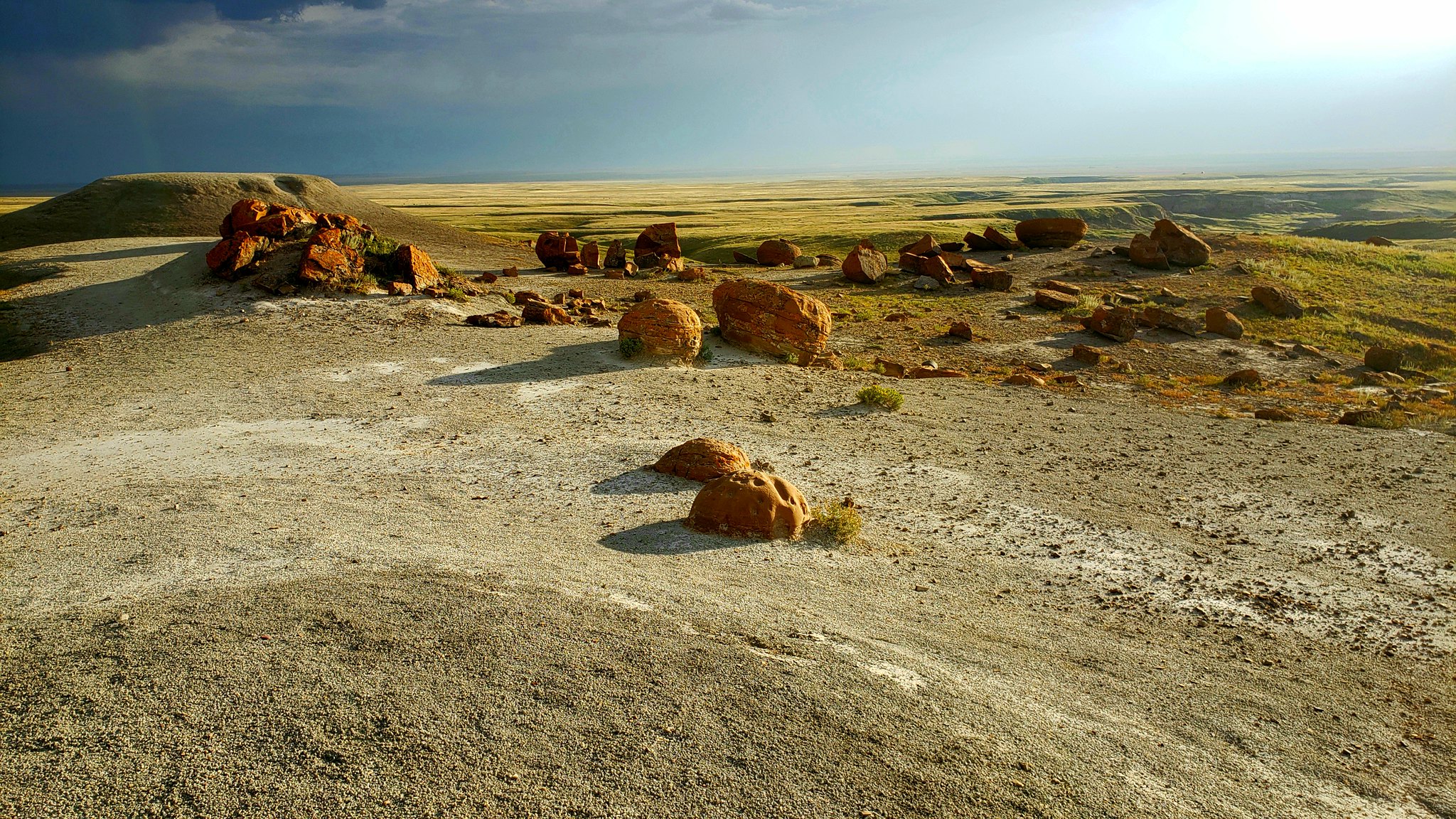
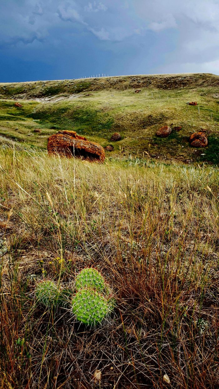
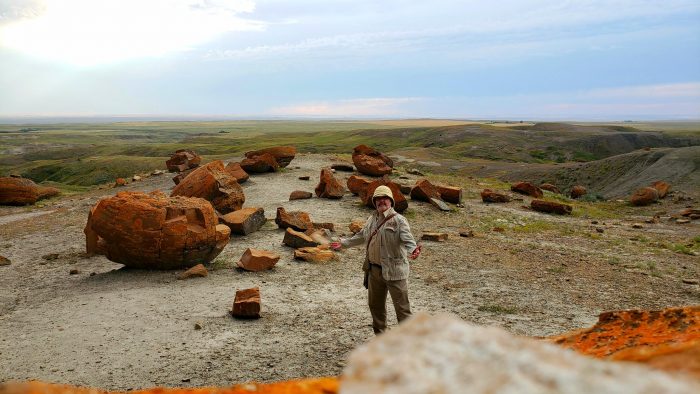
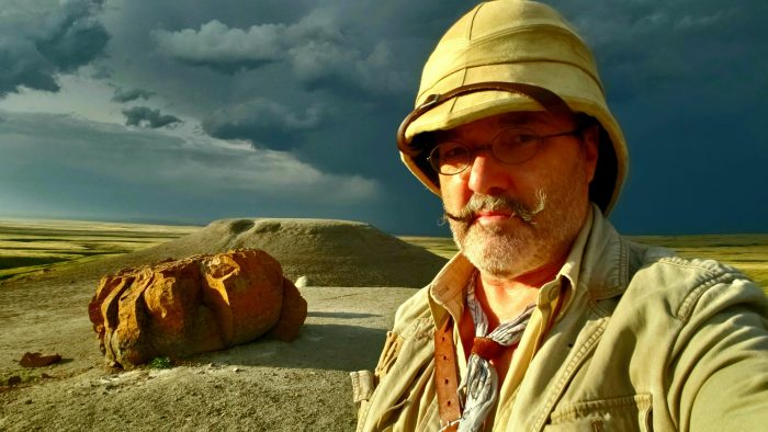
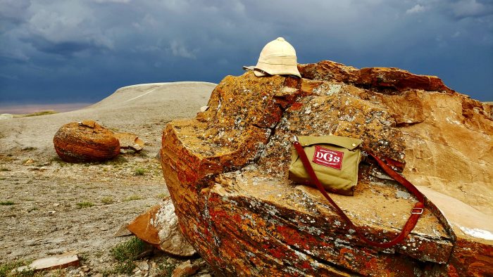
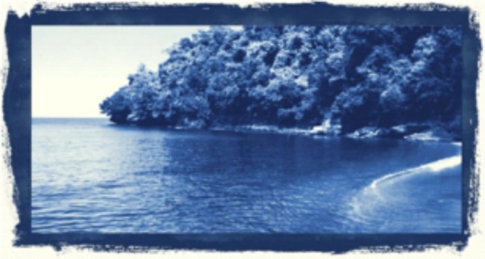
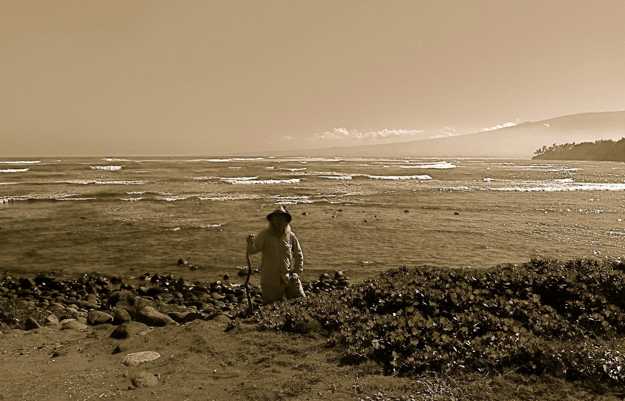
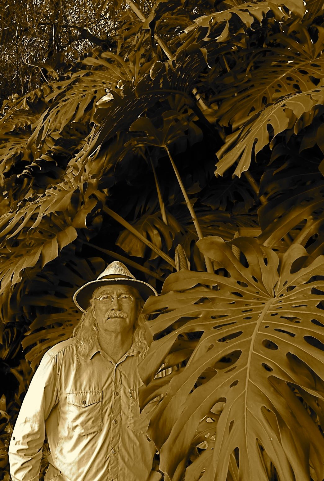
The landscape around was beautiful. A golden grass covered most of the area, with countershaded bushes growing to about calf and sometimes even chest height. Little taller grows. To the north, overlooking all, was the dark mass of Black Mountain. I realized, much to my delight, I was in the wash of the mountain, and kept my eyes trained to the ground to see what geological delights I could discover. It has been several years since I undertook any serious geologic study, but to my delight, among the pastel coloured rocks I discovered many waxy chalcedonies, jaspers predominating, pieces of quartz and serpintine with porous volcanic rock becoming more common as one approached any rise of geographic note. I quickly started placing any specimen I thought noteworthy in a pouch at my waist, little realising they would be the only real success of the expedition.

I had thought myself but a mile, perhaps a mile and a half distant, from the opening to the petroglyphs. As I crested the first rise, I realized that I was very much mistaken: using my binoculars and consulting my map, I was less that a fourth of the way there.

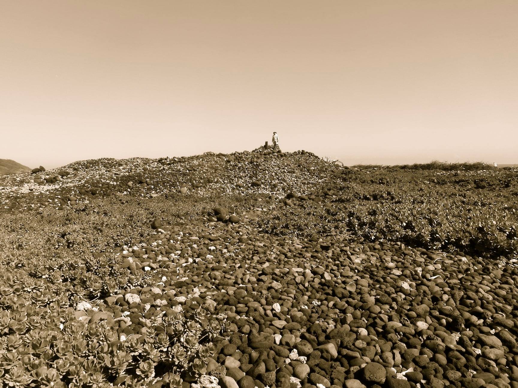
So on I marched, step after step, foot after foot, minute after minute, the edge of the mountain were I hoped the entrance would be becoming closer as time passed. The beauty of the landscape became monotonous, and my eyes, still trained on the ground, became more occupied looking out for anthills to avoid than rocks to pocket.

Alas! What I thought to be the entrance was merely a turn in the mountain, but I could definitely see the aperture now. It was as far away to me then as where I stood was from my initial position! I considered scrubbing the whole expedition, but I realised I had no choice but to continue. I had to at least make the petroglyphs, from there I could decide about the mine.

I kept going, singing songs from musicals in my head to keep me entertained. I had stopped noticing the grass now, and the rocks in my view were nothing but hazards to be navigated around. 30 minutes passed. On I went. 30 minutes passed. A quick break to rest my legs and eat and drink. 30 minutes passed. The breach, I could start making out details now. I could differentiate the closer side of the gap from the other. Keep going man, you’re nearly there. Is that? Yes! A road! Follow it man, it can only lead one place!

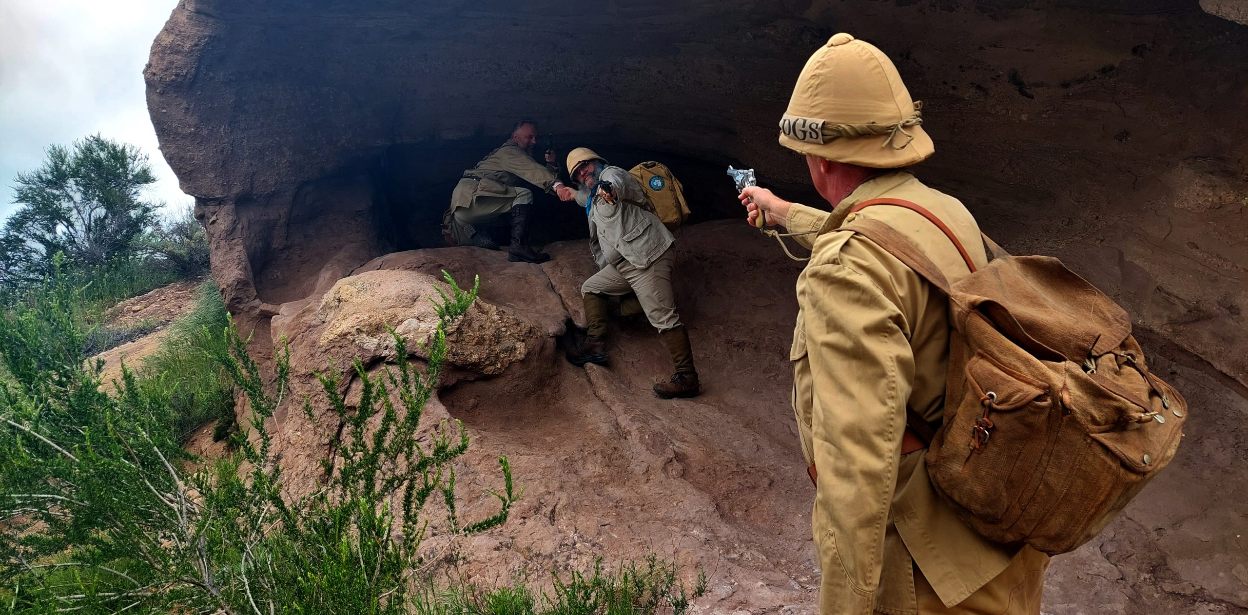
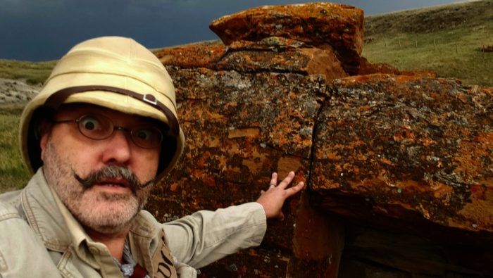
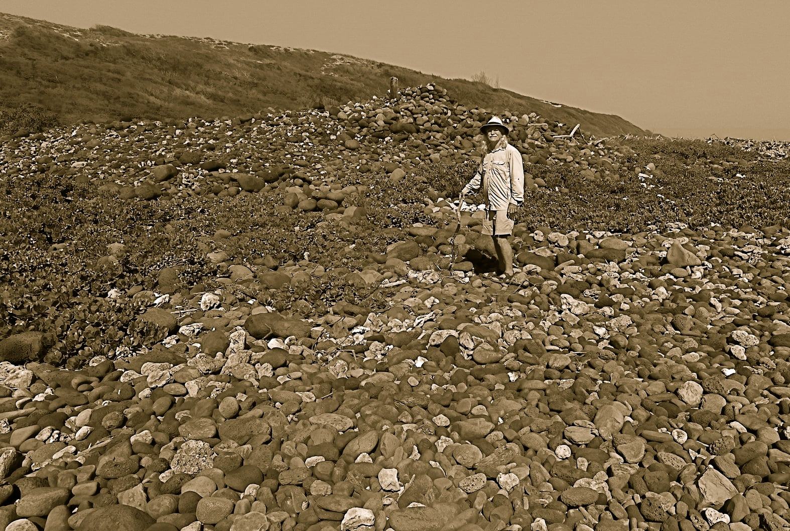
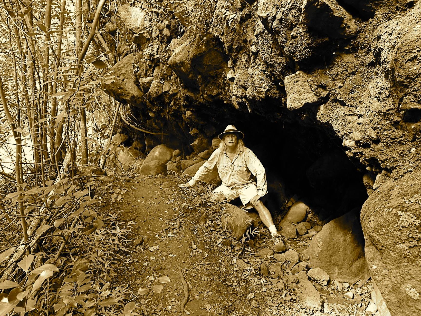
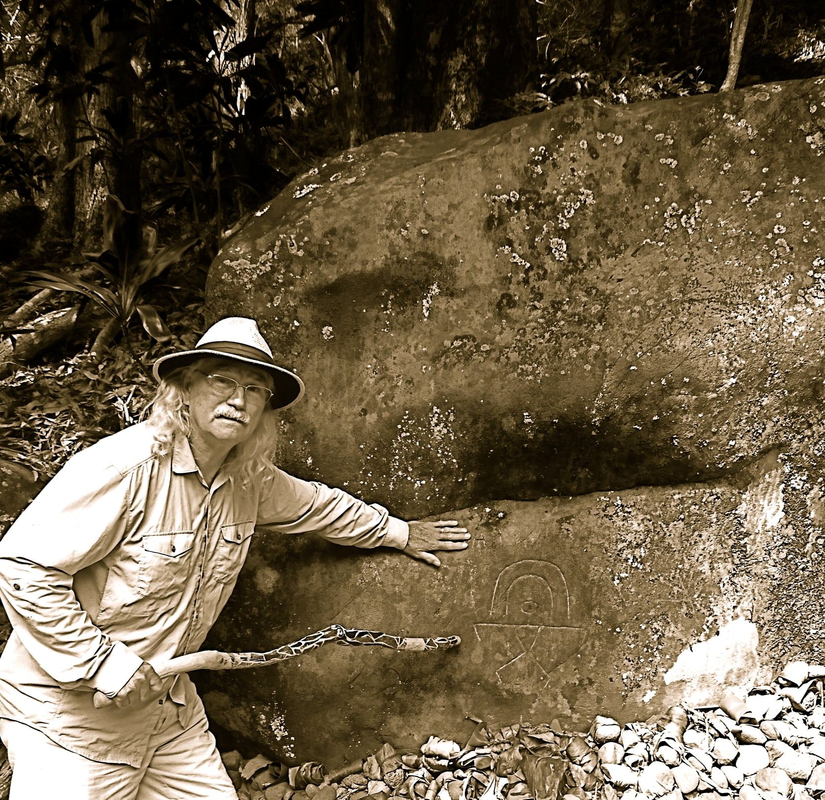
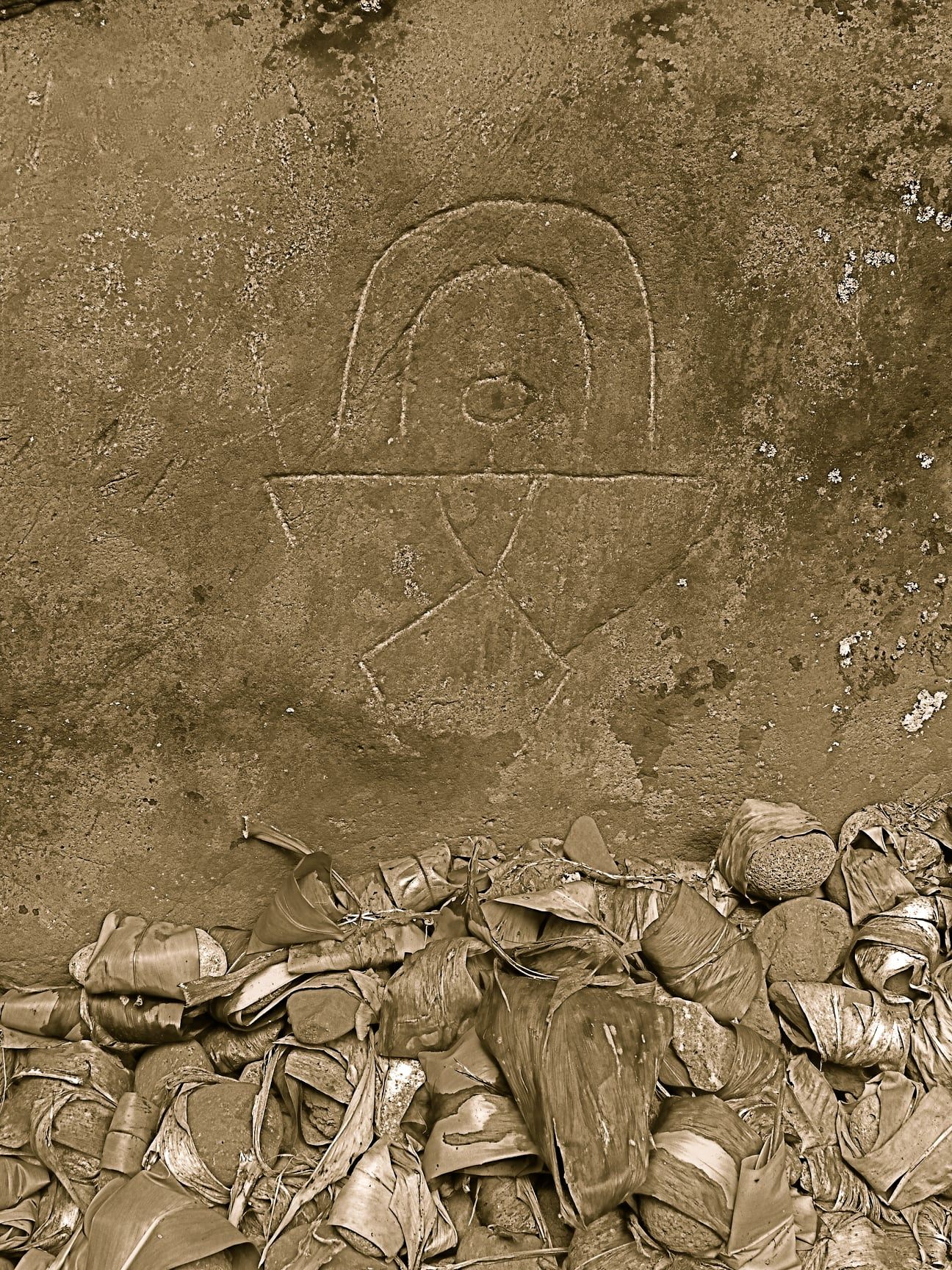
I had made it. I could see the remains of a fire pit and a campsite, set up within the curve of the road. I ate more of my provisions, and finished off one of the two large bottles of water I’d brought. On the other side of the camp, I could see a slight rise, a gap, and then a wall of stone rising out. That, I opined, must be Black Canyon. As I made my way over, I could see, carved on a rock on my side of the gap: a curve with a lightning bolt rising out of it. I sat down, and congratulated myself on making it. I took out my lunch, poured myself a cup of tea, and luxuriated in my accomplishment.

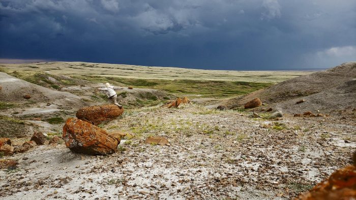
After about ten minutes, I thought about what would come after this. I checked my watch. It had taken me three hours to get this far, and, if my map was correct, it was even further to reach the mine. Unceremoniously I abandoned trying to reach it. “Something for the full expedition,” I thought. However, I realised to my horror that there was only three and a half hours of sunlight remaining. If I didn’t get a move on, and sharpish, I would be trapped in the desert on unfamiliar dirt roads in the dark.

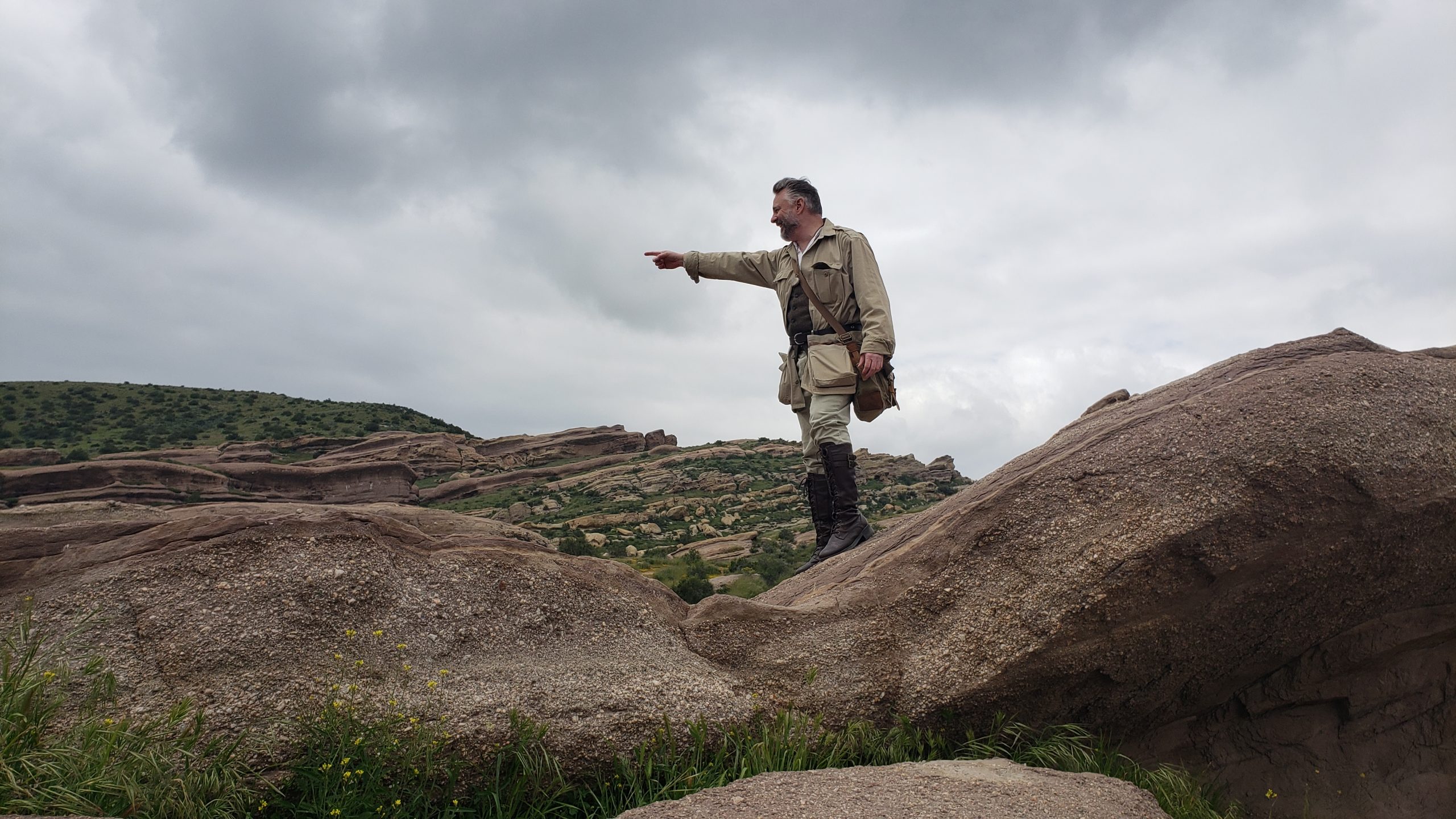
I gathered my belongings quickly, and turned back, following the road out. I saw a rather large ridge in front of me, and made it my target. As I climbed up, I took out my binoculars; perhaps I could see my car from here, and judge the distance. It was not good: my car, even magnified through my binoculars, was the size of a small bead, but I could see it. I took a reading on my compass. If I follow that, I reasoned, and did not deviate, I might just make it in time.

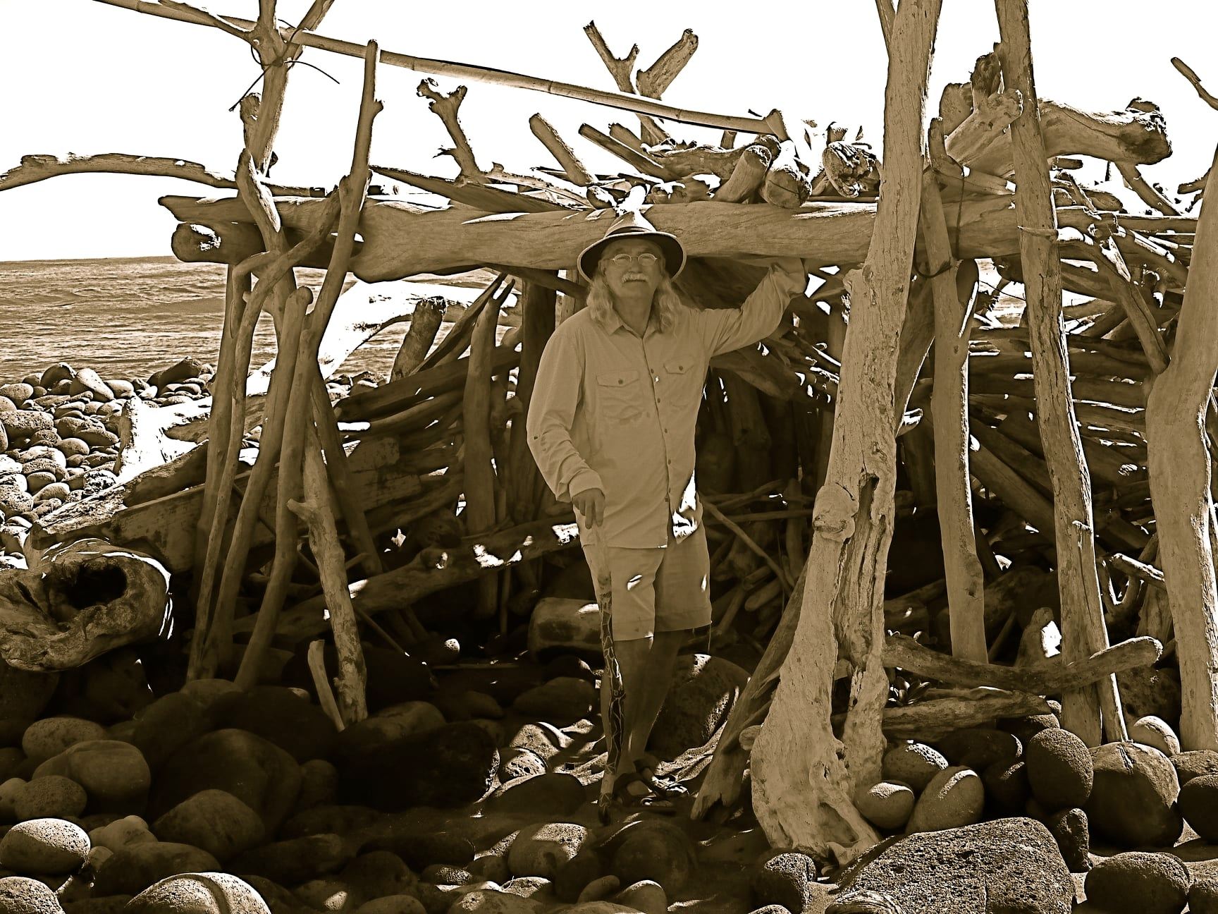
I was indefatigable in my march. No rest, no breaks; if I drank, I drank while I walked, if I ate, I ate while I walked. Where I kept my head down going out, I kept my eyes forward coming in. What took three hours before, through determination and drive took an hour and a half. I made it back to my car with shoulders sore from holding my bags, and my legs screaming from my long forced march. I was in just as much pain as I have ever been, but I had made it. I gave a whoop of joy, as the sun was only just beginning to climb down out of the sky. I quickly hopped in, started the motor, and drove away. As I got on paved roads again, the sun started to go orange.

In conclusion, I believe this is a site of absolute interest to the Society, given the archeological, geological, and possible gemological interests. However, should a full expedition be mounted, I cannot stress enough the necessity of proper planning: vehicles capable of handling the road are a must, and I would expect a full expedition to last three days at least: one load in, one exploring, one load out. The good news on that front is that a majority of the land around the mountain is under the jurisdiction of the Bureau of Land Management, and as such (if I understand correctly) one does not need permits in order to set up camp.

I thank you for your attention, and I hope this report has been to your satisfaction.

-William Marcil

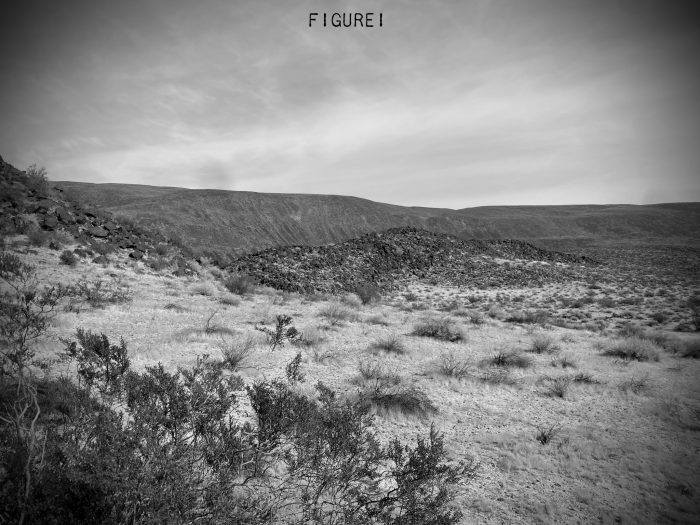
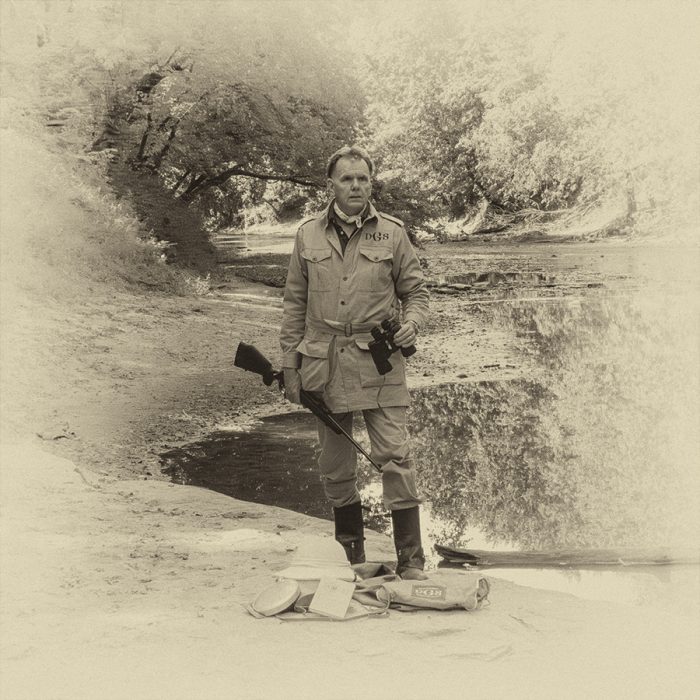
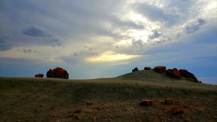
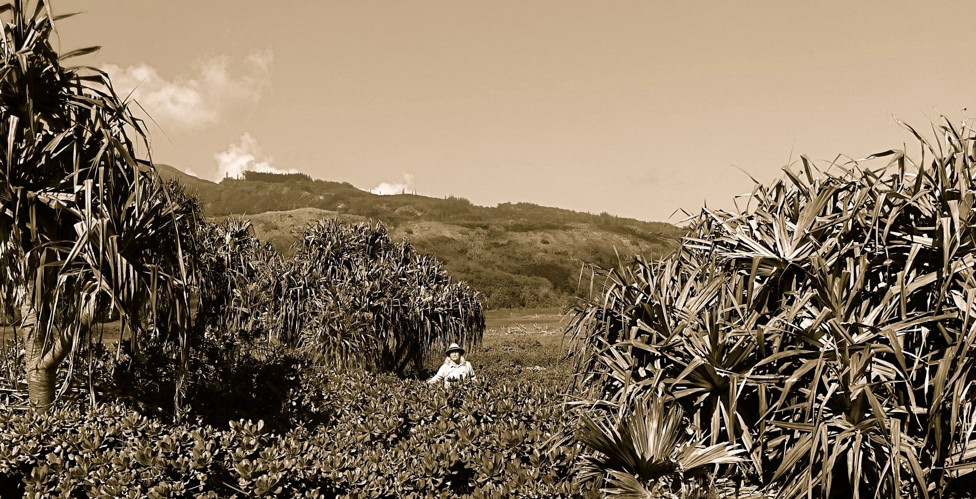
Figure I: Black Mountain and surrounding environs.

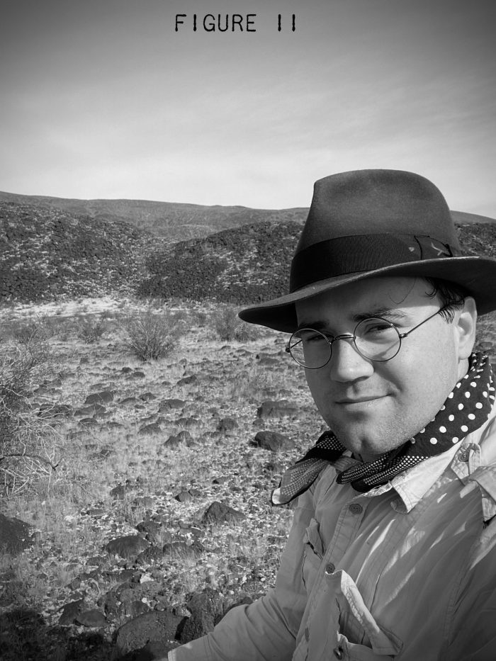
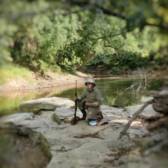
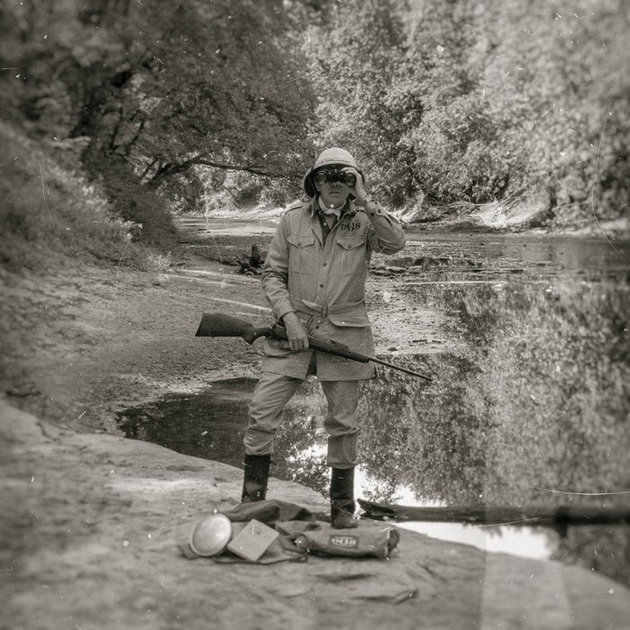
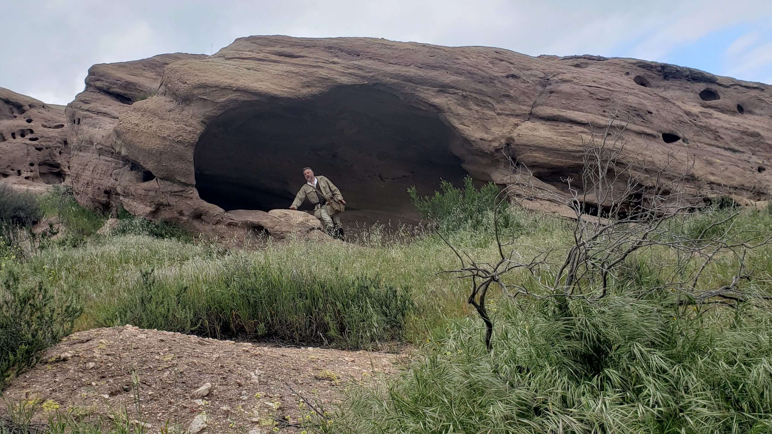
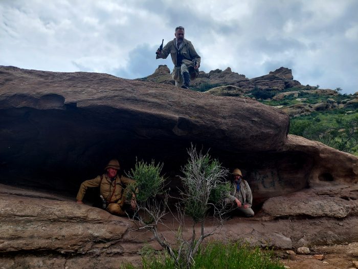
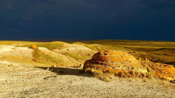
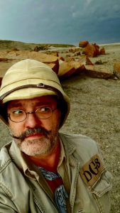
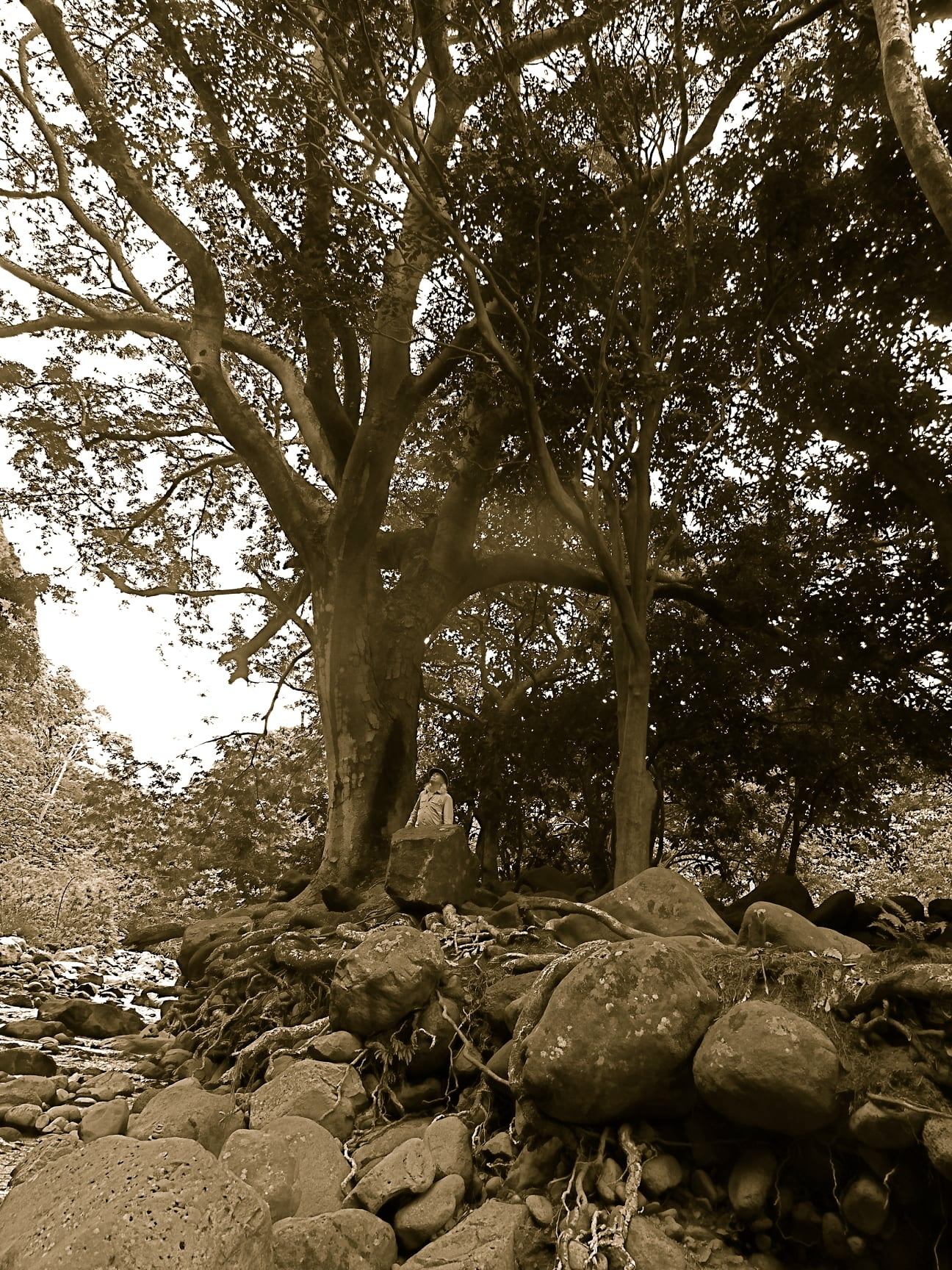
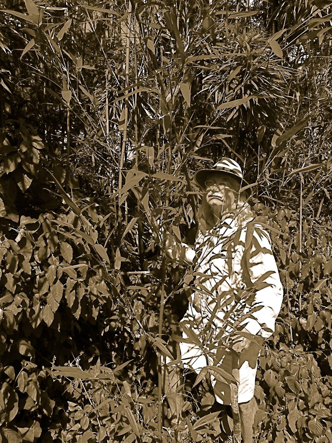
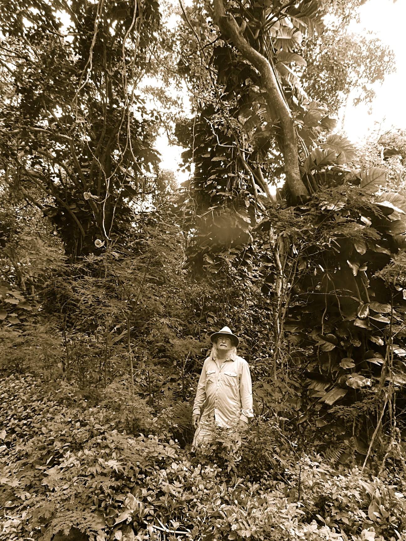
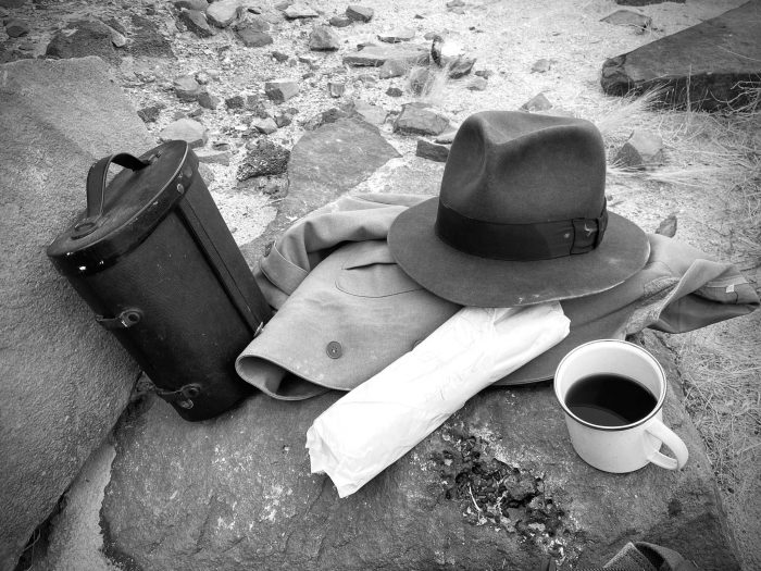
Figure II: The author resting his weary bones.

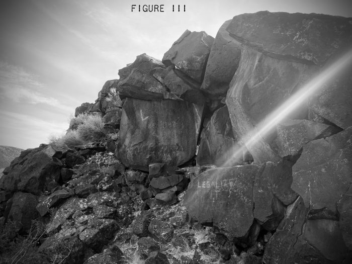
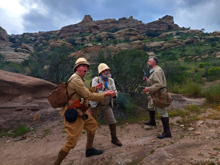
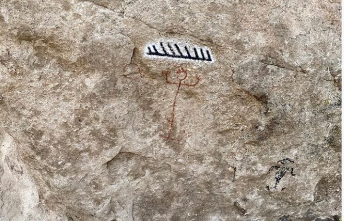
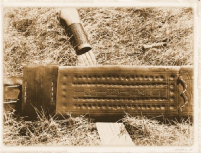
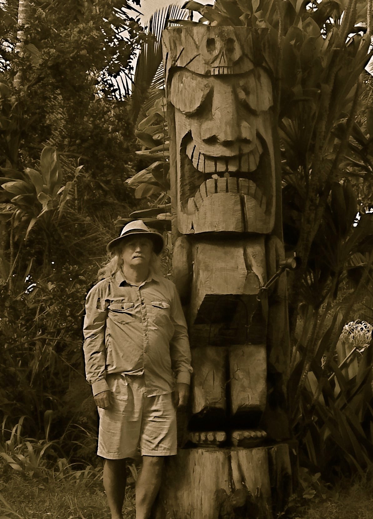
Figure III: The Black Canyon Petroglyphs Site. Unfortunately most of the glyphs in this photo are modern additions.


Posted in Rugged Peril | Leave a comment

Protecting Rhinos and Elephants from Poachers

ready to protect

nature from those who destroy

we’re always looking

-a haiku by Capt. Jas. Cox, Field Station 11N

Exploration not Exploitation™

Pigeon Creek Safari

Pigeon Creek Safari

Pigeon Creek Safari

Pigeon Creek Safari

Posted in General Discourse | Leave a comment

The Tataviam Expedition

In the barrens of Southern California, near the movie production City of Los Angeles, lies a massive geological feature collectively referred to as ‘Vasquez Rocks”. It was here, in 1874 Tiburcio Vasquez, one of California’s most notorious bandits, used these rocks to elude capture by law enforcement.

Long, long before that, the area was occupied by the Tataviam Indians. One  of their sacred sites at Vasquez Rocks is decorated with pictographs upon the stone walls. The area supposedly contains few red, white, and black pictographs depicting humans, spirits, animals and the sun and stars. According to scholars, the pictographs date back as far as 450 A.D. It was our mission to witness and document these features for our illustrious journals.

We had no guide nor compass, but we had a map, and a general idea, plus pistols for the snakes and cougars, if they were to give us trouble.

As always, we started with cocktails. Pictured: A.E. Sable, Cole Haley-Burton, B.W. Becker

Imagine all the deadly snakes sleeping in the pitted rocks!

Doubt Sets in.

Is it peril or is it a clue? Is it both? We’re always on edge.

I see something!

A cave!

Dissent!

Frustrated by lack of progress, Haley-Burton snaps. “Come down from there! I’m not going. Your map is a lot of malarkey! There’s nothing out here but certain and lingering death!”

We appeased Haley-Burton’s vexation with some shade, two cans of corned beef, and  a cup of Kentucky bourbon. Becker was still on guard, however.

This is what we were hoping to see.

Failure

Despite our failure, we will perhaps mount a second attempt to find the ritual site and learn more about the Tataviam people.

Posted in General Discourse | Leave a comment

The Last Bacci Ball Game of the Gods

My brother Duncan urged that I travel to Orion, Alberta, Canada, to see a striking landscape.

What must’ve happened here?!

He understated that entirely. It was more than striking. It was incredible!

Giant red stone balls sunken into the earth, some smashed open!

There were many cacti in the area. A place to watch your step!

It was apparent this was also a place favoured by rattlesnakes. I heard them, but didn’t see them.

Can you feel the power of the mighty, god hewn balls?

There are so many! And scattered so far!

Clearly, this must’ve been the remnants of an ancient Bacci Ball match played by the gods in ancient times. These gods must’ve fought violently by throwing the balls at each other, causing some to shatter. The balls were so eroded, the game must’ve been played deep in pre-history, by forgotten gods perhaps never to be identified.

That is my scientific opinion.

I heard the contant rumble of distant thunder.

A serious tripping hazard.

Light broke through the threatening storm clouds

I left before the storm came, in awe. And in reverence.

Report by Captain A.E. Sable, September, 1922

Posted in General Discourse | Leave a comment

Be Prepared: The Oldest Pub in Saskatchewan

I haven’t deliberately done any DGS excursions this summer, so far, but I try to be prepared for incidental adventures. Pith and kit in the trunk, just in case*.

I met up with my brother just past the Saskatchewan border, in Maple Creek (a place I’d never been; halfway between where we each live), and we did a whiskey shot at the oldest public house in the Province.

The Sable Brothers in the Oldest Public House in Saskatchewan

The Jasper Hotel opened in 1903 and has been continuously open since then. Maple Creek is a hub central to three borders, including Montana’s. The current owner of the Jasper was very proud of his bar’s history and told us about it and the artifacts within the bar. He even had us carded because the server wouldn’t.

Inside the bar

The bar within the bar was from an earlier business, an 1890s hardware store.

The bar is older than the bar! It was from a hardward store built in the 1890s.

 The safe was a specialty, state of the art item shipped to the bank in 1912 and later donated to the Jasper.

Safe Cracker

There’s a 100+ year old photo of the hotel on the wall.

119 years ago, maybe

The saddle was owned by the first owner of the bar, who broke her back on her first horse ride and never rode again. It’s been on the wall for over 100 years.


The Jasper Hotel Bar, Maple Creek, Saskatchewan

Quite a joy to visit, but we barely spent 15 minutes there.

*I did throw on the gear for the Red Rock Coulee side trip my brother convinced me to go on. Post coming soon.

Posted in General Discourse | Leave a comment

OUT and ABOUT, a serial by R.J. Oldcastle

OUT and ABOUT  The Collected Quasi Non-fictional Recollections Of the Occasional R.J. OLDCASTLE, Part One

PREFACE

The following are the hazy anecdotal memoirs of some of the adventures of Robert John Oldcastle.  They have been assembled with illustrations taken by the author.  They are quasi non-fictional (or fictional).  All of the events happened in the locations described, but not necessarily in the larger context of the story as a whole.  Some names have been changed to protect the actual identities, with no innocence or guilt implied.

The author occasionally digresses into observations and advice for travellers and explorers gleaned from his experiences.  These are offered in the hope that his readers may learn from his hard knocks rather than suffer them themselves.

So, in that context, I hope you enjoy them. -R.J.O.

Chapter One

TRINIDAD – ‘69

It was the summer of ’69 that started my life of travel and adventure.  I was really too young in June of that year to apply for the job that was advertised one evening in the Toronto Globe newspaper:

Wanted:          Earnest, intelligent, young man that is willing to travel.  Must be available immediately for 2-month commitment.  Must be comfortable with outdoor work and be conversant with survey fundamentals.  Apply in person.

And they listed a room number at the Queen’s Hotel on Front Street.

As well as my regular schooling, I had been active in the local “Drill Association” for two years and was quite conversant with basic military map & compass work.  I had been fortunate to be able to advance quickly through my studies and passed my Junior Matriculation exams at a young age.  Now school was out and I was free for the summer.

At 8:00 am the next morning I presented myself to the address indicated in the newspaper and was met by two gentlemen.  I presented my Junior Matriculation certificate and military identification and somehow convinced them that I was older than I appeared.  They asked me a series of questions on the Mercator projection, magnetic variation and the like.  They were surprised at my accurate answers and asked for a sample of my handwriting.  They then asked if I was able to leave in three days’ time.  I gulped and said, “Yes”.  “You’re hired”, they replied. Then I remembered to ask, “Where are we going and how long?”  They replied, “Trinidad, and you will be gone for at least six weeks. Be at Union Station by 9:00 a.m.  We leave for New York from Track 9.”

They gave me a list of personal equipment I would need, a train ticket and an advance of $20.00 cash!  Only then did I think to ask what we would be doing.  They had a contract to instruct surveyor’s assistants for an upcoming large scale topographic survey of the island.  I was to be their peon!

That night there was an animated conversation with my family.  They finally relented and supported me in my first real adventure.  I spent the next two days in madcap shopping and packing the necessary tropical kit.

There were many memorable moments, but I’ll mention only a few.  The northwest corner of Trinidad is only a few miles from the South American coast of Venezuela.  There is a region of jungle covered highlands along the northern part of the island.  We were based north of Port of Spain in that hill country.  The government had assigned us a building, however shortly before we arrived it had been burned down by monkey hunters.  We ended up living in a warehouse-like structure that was open on both ends. We slept on cots, listening to the jungle noises including the eerie sound of Red Howler monkeys.  That was my first experience living with snails the size of golf-balls and two-inch cockroaches.

We were warned about poisonous snakes in the area and told not to walk into the jungle (and even be careful on the tracks and roads).  I wondered whether we were being teased until I saw a dead Fer-de-Lance that had been run over on the road into our camp.  The snake was over three feet long and with a dull colouring that would effectively camouflage it in that terrain.  The Fer-de-Lance is a pit viper whose bite is fatal.  Our new friends were not joking – thus I learned to always listen to the local experts when they offer advice.  I bought a walking stick with a snake carved around it as a memento of that day.

An amusing episode happened on one of our visits to Port of Spain.  The three of us were wandering along a side street on a hot afternoon.  Summer is the rainy season and the daily afternoon rain torrent opened up on us.  We spotted a sign that said “Recreational Club”.  It was at the top of a set of stairs leading to a roofed balcony overlooking the street.  Up we went.  We sat down at a large table and ordered rum punches.  The price the waiter asked was exorbitant, but we paid.  Then a parade of rather rough looking “ladies” began to walk past with enticing smiles, making rather provocative comments.  It was at that point we realised what kind of “recreation” the sign referred to.  We downed our drinks and escaped into the warm rain.

We took time to make trips around the island which allowed for a couple of interesting swims.  Macqueripe Bay on the north coast has a beautiful beach. While swimming we saw giant manta rays offshore just below the surface that must have had an eight-foot wingspan.  Closer to shore, we saw Goliath Groupers below us that we were told were between two and four hundred pounds.

The scariest event I experienced was when we visited the small island of Gaspar Grande.  I ventured away from the group and went for a swim in a small bay amongst myriad small colourful fish.  When I was about one hundred feet from shore and in about ten feet of water, a long thin fish swam between me and shore.  He was at least five feet long!  Barracuda!  I was out of the water as fast as I could make it.  Our local friends laughed at me and assured me that barracuda never attack anything larger than themselves.

That summer, I learned a lot about how wide the world was and how I so much wanted to see more of it.


End of Chapter One.


Posted in General Discourse | Leave a comment

Exploration of the Wailuku area of Maui, January, 1910

With temperatures hovering around 30 degrees below zero (-22°F) in Calgary, it seemed a good time to journey to the American Territory of Hawaii. My lovely wife, Lady Eleanor, accompanied me in the role of photographer so we could document this historic venture. Ever since the overthrow of the Kingdom of Hawaii in 1893 and the subsequent annexation by the United States five years later, the development and exploitation of these islands has moved at a breakneck pace. I wanted to see what remained of the older island culture before it all disappears.

The Waihee area was inhabited long ago. A fertile valley along the Waihee river was extensively planted and supported a large village.

One of the first hotels in Maui was the Pioneer Hotel. When George Freeland arrived in the Lāhainā on a ship that had just come from a long voyage through the south seas in 1901, he noted the need for a hotel. George organized a stock company, Pioneer Hotel, Ltd., immediately began construction, and the hotel opened the first week of December 1901. It remains the only place for visitors to stay on Maui’s west side.
The northshore town of Paia has it’s roots in the plantation camps which housed workers of the Paia Sugar Mill which opened in 1880 The Paia store was built in 1896 to support the needs of the immigrant sugar workers attracted from many different cultures and races who came to work in the mill or nearby cane fields. Paia’s people are a mix of Chinese, Filipino, Japanese, Korean Puerto Ricans, Portuguese, and Native Hawaiian who live and work together in harmony.
Other than the railroads and roads used for commercial enterprises, transportation around the island is relatively limited. Having a friend who settled in Wailuku town some 20 years ago, and I used his estate as a basecamp to explore the sites and ruins in that area. The establishment of Wailuku as the County seat in 1905 has encouraged additional business activity and the town has become an important commercial centre.

The village overlooked the ocean.

Recent pilgrims to the area have used the abundant driftwood to construct crude shelters.

The estate lies near the banks of the Iao stream which flows out of the West Maui Mountains, close to where the old water powered sugar mill was built in 1882. In 1890 the mill was moved about 1 mile to the northeast to a site along Halewili Street, and steam driven equipment was installed. The original mill site is now used as stables for the Wailuku Sugar Co.
During the years since the mill was moved, the area south of the original mill site has had more streets laid out and more buildings developed. The commercial core of Wailuku has grown up in this area, along Market, South High and Main Streets, with dwellings set behind these streets and on side streets.
The Iao Valley was the site of the infamous battle of Kepaniwai in 1790. King Kamehameha sought dominion over all the Hawaiian islands and landed his war fleet at nearby Kahului while Maui’s chief, Kahekili was away on Oahu. He pursued Kahekili’s son Kalanikupule and other Maui chiefs deep into ‘Iao Valley. Kamehameha’s warriors were aided by his Western cannon, called Lopaka, and two foreign advisors who operated it. Many were slaughtered in the bloody battle, called Kepaniwai (“the damming of the waters”), because bodies literally dammed the stream which flowed red with blood. It suggested an interesting area to investigate.

The remains of Kealaka’ihonua Heiau, a temple dedicated to Ku, the god of war, politics, and fishing.

Kealaka’ihonua Heiau includes a platform surrounded by a paved area. There would have been thatched buildings and carved images on the platform when it was in use. Missionary zeal has destroyed all evidence of these.

Surprisingly little evidence of the Battle of Kepaniwai remains. 120 years of the tropical climate have returned the area to a natural state of tranquil beauty with no sign of the carnage that once occurred here.

Nothing remains of the great battle that took place here.

Following the Iao stream into the Iao valley.

Banyan roots provide easy access to the higher levels of the valley.

Despite the hardships of travel during the current plague, I found the trip a pleasant break from winter in the Dominion. While mosquitos and spiders are very prolific, there are no snakes in the jungles of Maui, allowing a more relaxed exploration than in similar environs elsewhere. I would recommend the excursion during the Dominion winter. From my friend’s observations, I would avoid summer there due to the extreme heat.

This ancient figure is known to the native Hawaiians.

Offerings of rocks wrapped in ti leaves are piled at the base of the rock.

Working my way through. the dense jungle wasn’t always easy.

Feral cats prowl the wilderness.

The webs of cane spiders are a constant hazard, clinging to the faces of the unwary.

Abundant moisture in the jungle creates massive foliage.

This tiki now stands near the entrance to an estate outside Paia. It may once have stood atop a heiau.

Native fauna.

The Waihee area was inhabited long ago. A fertile valley along the Waihee river was extensively planted and supported a large village.

Lady Eleanor Reinholt, photographer for the expedition. All other photographs in this report were taken by Lady Reinholt.

The transition from minus 30 (-22°F) to plus 30 (+86°F) left your intrepid explorer wrinkled and, dare I confess it, sweaty! Despite my deplorable appearance, I have included some photos with this report so that you can judge the conditions that exist in this area today.
Submitted this 6th day of February, 1910
Colonel Reginald Reinholt, DGS
Posted in General Discourse | Leave a comment

The Mystery of the Abandoned Fort

Having lost my sailing companion from The S.S. Eldritch, Carleton, amidst a street brawl, I’d occupied some of my time by laying low and hoping for his return away from the City of Havana proper by lingering about the Malecón sea wall and eventually the windy beach and attempting to collect lizards from the hot rocks. The curly tailed ones ate the small brown anoles and beat up the larger green ones until I separated them in large jars inside my satchel. It occurred that I didn’t know what they ate and I’d have no one to deliver the jars to in any case, so I’d just let them loose and observed their skittery and odd behaviours until they left my sight.

I’d never seen lizards outside of a photographic plate in a book before.

After thinking absently on the dunes, staring out to sea, I considered perhaps someone at one of the military fortresses around the harbour might know where my troop ship would be docked and I could rejoin the Frontiersmen Expeditionary Forces and not be shot for accidental desertion back in Halifax.

After talking to many cinammon hued beach goers, and me not knowing a word of Spanish, I finally found a young man who could speak heavily accented English, fishing on the beach. He directed me to Fortaleza de San Carlos de la Cabaña, adding in a few tidbits of local pride by saying it had never been attacked because of how formidible it was. It has 120 cannons and housed between 1.300 and 6,000 men, in times of war, and those times looked like they may be coming. Surely someone here, perhaps the Fortress General, could wire my ship and regiment before my situation fell even more out of hand.  The lad also explained to me that his compatriots casually called it La Cabaña. and anglos wrongly called it Fort Charles. It was just overland from where we spoke.

“Just overland” turned out to be over an hour and this Canadian felt the heat despite the cool linens of my suit and my white sun helmet. Once I’d arrived, I’d found it curiously unguarded. I walked across the drawbridge without challenge!

It seemed very quiet for a military fort housing over a thousand souls.The Mystery of the Abandoned FortThey easily had 120 cannons, perhaps more. But no one manning them.

Another curly tail lizard with a straight tail. At least there was some life here!

It did seem ridiculous that there was no one here. Perhaps the fort was so imposing, the mere existence of it was threat enough for potential invaders to steer clear of the harbour. The barracks were all locked, but silent. Not a movement anywhere, save the lizards.

I’d found the Officers Building and eventually found the General’s Office, but it was as vacant as the rest of the fort.

The General's Desk

The General’s Desk

It was a mystery never solved. I’d have to ignore my plight and seek a meal and room in the city across the harbour. I sat in a cool courtyard overgrown with tree roots until the sun felt less harsh and more managable. A walk at night in a foreign land is more of an adventure, anyway.

Tree roots in the Fort

Tree roots in the Fort

Posted in General Discourse, Rugged Peril | Leave a comment